How far is your walk across campus? Considering walking from a transit station to work? Looking for a lunchtime walk? There are a number of online and mobile applications that can help your estimate walk distances.
Google Maps
Google provides two useful tools for estimating walk distances and times:
- Walking directions from your location to your destination: To get walking directions, enter your to and from destinations. On the upper left side of Google Maps, just below your to and from addresses, there’s a drop down box to select your mode of transportation. Select the “Walk” icon you would like walking directions (typically along sidewalks or trails. If you grab the recommended route, you can drag it to view other route options you may prefer.
- Measure distances (as the crow flies): Google also allows you to measure the distance between two points on a Google Map.
RAMmobile 2.0: Google Play or iTunes App
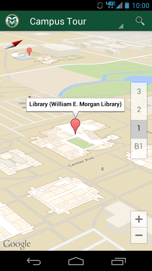 Colorado State University provides a simple navigational app with maps depicting all buildings on campus. The app will pinpoint your actual location and will help you navigate to your desired destination on foot. The app is available in the iTunes and Google Play app stores.
RideTransfort app
While this app is designed for the TransFort transit system, the application provides to two useful walking features: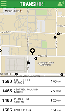
- Selecting the “Trip Planner” under the app menu, you can enter your to and from destinations. If you select “transit” as your mode of transportation, it will give you the walk distance to your closest transit stop to connect with the bus.
- Under “Trip Planner,” you also can select “walking” as your mode of transportation. This app will provide step-by-step driving directions.
The app is available in the iTunes and Google Play app stores.