Google Transit: Find a route to CSU

Thinking about riding transit to CSU, but not sure where to get started?  Worried about missing the bus?GoogleBike3

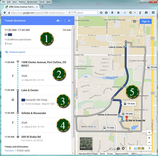
All Transfort routes, including FLEX , Poudre Express, and MAX, can be found on Google Transit.

Google Transit is an online schedule and map that can help make your riding enjoyable, predictable and stress-free.

Follow the steps below to use your free CSU employee and student transit pass (Ramcard).

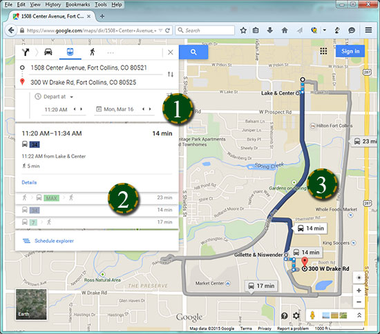
Step 1: Enter route details

  1. Enter your pick-up, or from, address
  2. Enter your destination, or to, address
  3. Select your options. Under “Best Route,” you can select “Less Walking” or “Fewer Transfers”

Step 2: Select route preference

For this example, we’ve selected the Lake Street Garage to the Veterinary Teaching Hospital:GoogleTransit2

  1. Enter your travel time by confirming the date and time you wish to travel. Adjust the time earlier or later for additional route opportunities.
  2. Select your route from the list of routes that attempt to meet your time constraints.
  3. Map your route. You can select a different route from the list or by clicking on a grayed-out route.

Step 3: Review your route summary

  1. Your route summary is available after selecting a route. The summary appears with conservative time duration estimates and bus stop information.GoogleTransit3
  2. Estimate your walk time. Google Transit estimates the time to walk from your building to the bus stop. Light blue dots represent the walking portion of the trip on the map.
  3. Find your bus number. The bus number guides you to which bus to take. Any transfers would be indicated here with a unique color for each route.
  4. Walk to your destination. Google Transit estimates the time to walk from the bus stop to your destination. Light blue dots represent the walking portion of the trip on the map.
  5. Map your route. All walking and transit portions of the trip are represented on the map.